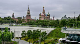
NASA unveils its top 15 Earth images from this year (PHOTOS)
From dust plumes over the Sahara Desert to the floodplains of the Mekong River, Mother Earth is a gorgeous sight to behold from many angles – and the best images taken in 2015 by astronauts aboard the International Space Station prove it.
This list of top images was selected by members of the NASA Johnson Space Center's Earth Observations team.
Lake Chad and a Bodele Dust Plume in the Sahara Desert
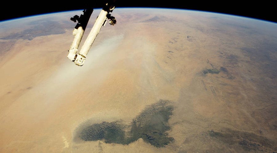
"The dark green marshes of Lake Chad stand out in the foreground of this view," NASA wrote in describing this photo of the arid landscape of the Sahara. An active dust plume can be seen in the left half of the photo.
Hawaii’s Kilauea volcano

Kilauea is surrounded by swirls of its own volcanic gases, known as von Kármán vortices, which form "under specific conditions of high atmospheric pressure and relatively slow wind speeds," according to NASA.
Sierra Nevada de Santa Marta in Colombia
The view of the highest peaks of the Santa Marta massif reveals summits "so high that trees cannot grow — landscapes appear gray because only grass and small shrubs can survive the cold," NASA wrote.
Scandinavia nightview
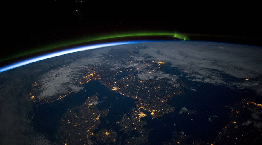
A green aurora in the north and the darkness of the Baltic Sea in the lower right of the photo highlight this view of Norway, Sweden, and Denmark.
Parana River in Argentina
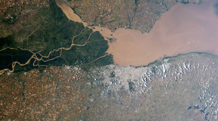
South America's second-largest river is seen dumping brown muddy water into the River Plate estuary, shown at center right.
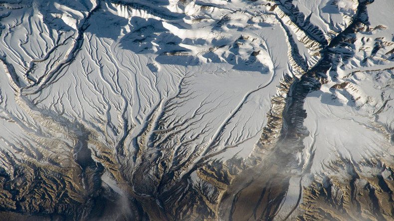
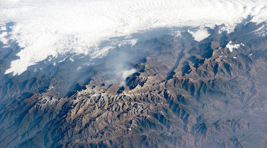
The Himalayas, at the China-India border
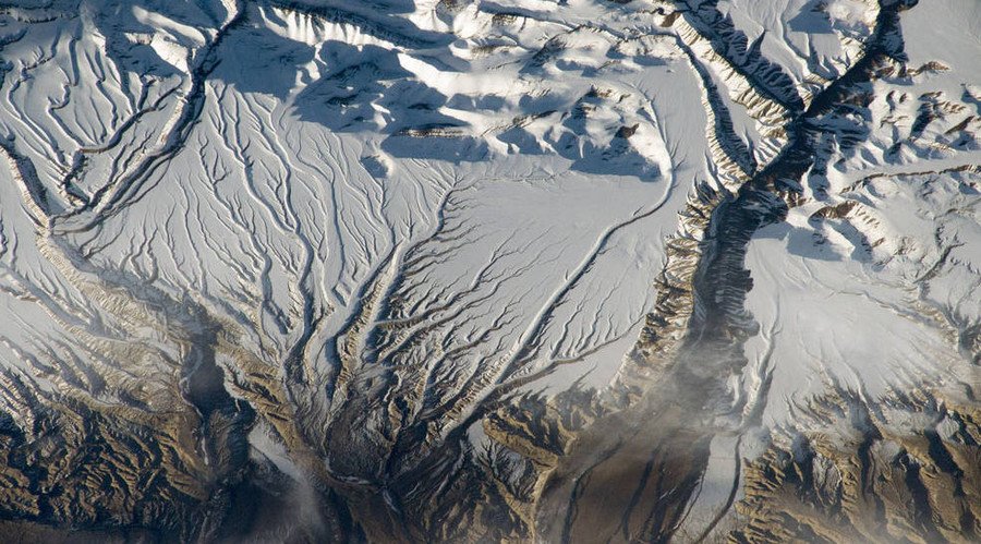
This view of the snow-capped Himalayas displays gullies cutting through rock thanks to millions of years of erosion.
Laguna Colorada in the Bolivian Andes Mountains
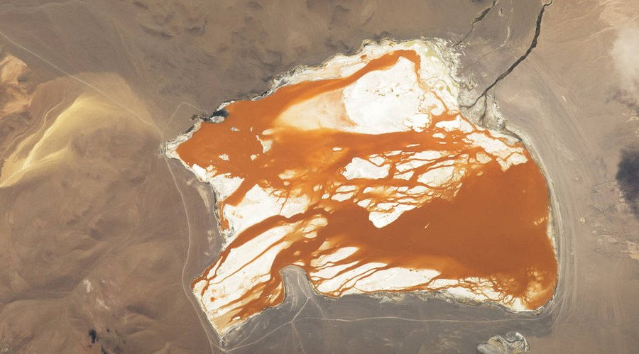
This saltwater lake, sitting 4,300 meters (14,100 feet) above sea level, has a red-brown color due to robust algae collections.
Adele Island in Australia
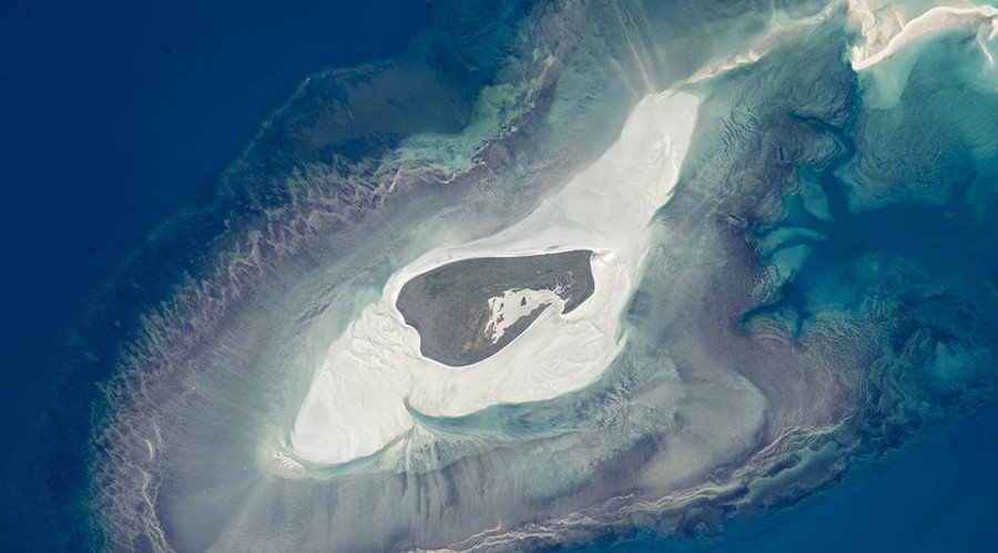
On Australia's north coast, Adele Island is "made up of a series of beach ridges built by sands from the surrounding sandbank during storms," NASA wrote.
Salt Ponds of western Australia
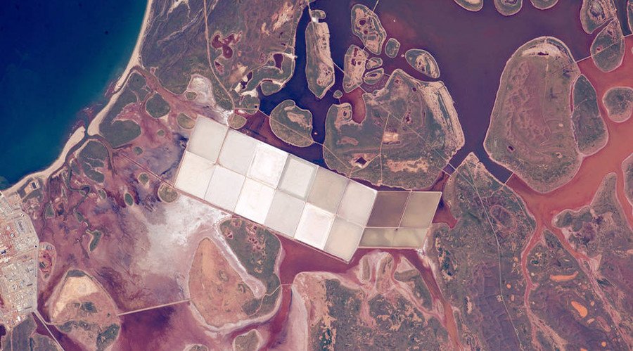
The "angular, white ponds" were formed by the salt extraction industry, in contrast with the various islands set amid coastal lagoons.
Cape Cod, Massachusetts
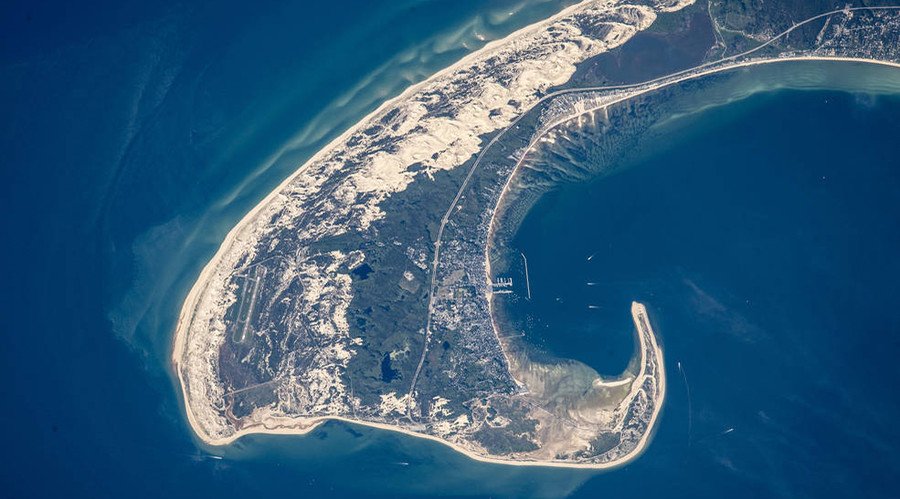
This view of the northern tip of Cape Cod shows the cape's odd shape, which was formed by glaciers around 20,000 years ago.
Port of Sfax in Tunisia
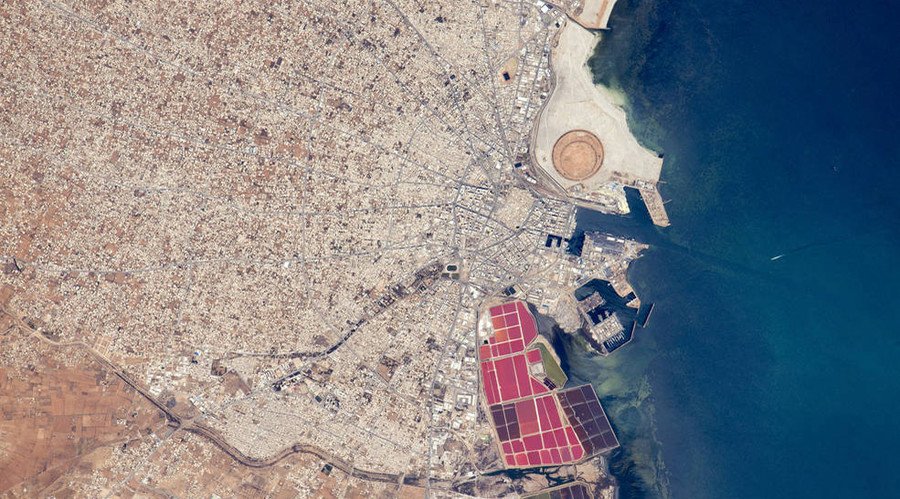
Sfax's streets burst from the city's bustling port. Its shore is highlighted by "brilliantly colored salt ponds south of the old city and the new circular earth works of the Taparura redevelopment project," according to NASA.
Mekong River between Thailand and Laos
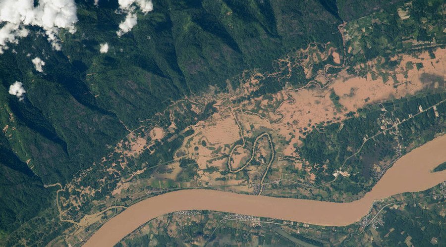
Floodwaters from a heavy monsoon are visible in this view of Southeast Asia's largest river.
Red Sprites over Mexico
Red sprites, or major electrical discharges, are seen above the white light from an active thunderstorm over northwest Mexico.
Fish farms in China
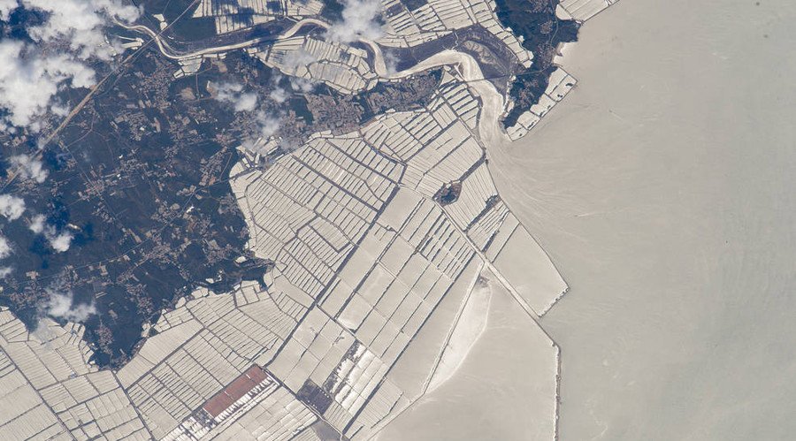
Fish-farm basins seen along the coast of China's Liaoning province face the Yellow River.
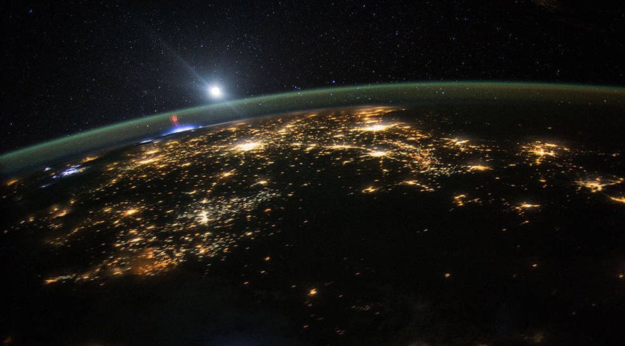
India-Pakistan border
Security lights along the border between Pakistan and India are seen as "a distinct orange tone" at night, NASA wrote.