Vast underground river system discovered in once-vibrant Western Sahara
A riveting mystery is unfolding in Western Sahara, as scientists discover a massive ancient underground river system with the aid of satellite imaging. It confirms that only about 5,000 years ago, the Sahara was an immensely vibrant place.
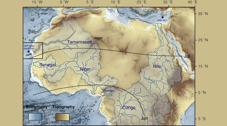
The African region containing the Mauritanian Desert is roughly the size of the United States – or a quarter of Africa; so if such conditions persisted today, the river system would be the world's 12th-largest, French-led research indicates in the journal Nature Communications.
That means a river some 500km long, with sources in the Atlas Mountains and Hoggar Highlands, in present-day Algeria.
The team used hi-tech equipment aboard the Japanese Advanced Land Observing Satellite – particularly the PALSAR sensor system, capable of detailed underground imaging from space.
READ MORE: Satellites show world is running out of water - new NASA study
As the river approached the coast, it carried important minerals and nutrients by way of an ancient underground canyon system, the team believes. Those were fed to the variety of plant life, which existed in abundance in the region and off the coast of Mauritania, as food for marine life. The region just off the coast had an incredibly rich ecosystem, with plenty of filter feeders and other organisms sustaining it.
If that area had stayed hospitable, the entire region would be fit for humans to thrive in.
All of this activity took place during several humid periods stretching to 245,000 years ago. The last such period would have been 5,000 years ago, according to calculations. But abrupt changes in climate caused a near-complete dry- up.
READ MORE: Finding life on other planets just got easier with new scientific method
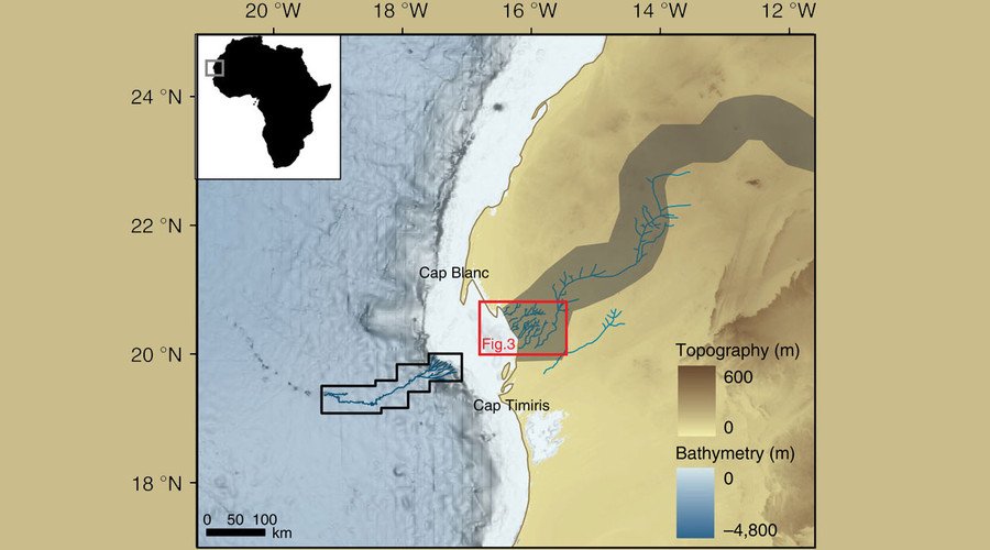
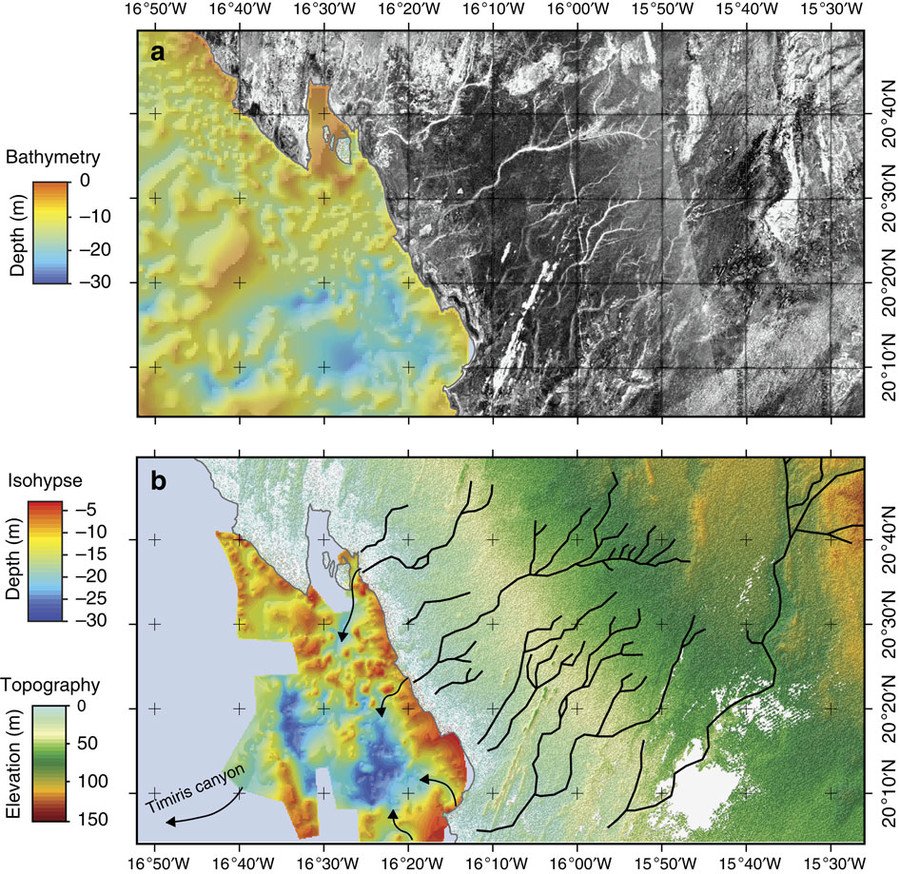
The connection with the Cap Timiris Canyon system is obvious – the underground canyon lines up almost perfectly to the river system.
The 2.5km wide and kilometer-deep artery that was first mapped in 2003 terminates off the Mauritanian coast. Underground sediment and river-bone particles found at the bottom of the ancient underground shelf establishes the link with inland Africa.
“It’s a great geological detective story and it confirms more directly what we had expected. This is more compelling evidence that in the past there was a very big river system feeding into this canyon,” Russell Wynn of the National Oceanography Center in Southampton, who helped create the 3D map of the canyon, told the Guardian. He was not part of the current research.
As the researchers indicate in the study, the current finding “provides new insights for the interpretation of terrigenous sediment records off Western Africa, with important implications for our understanding of the paleohydrological history of the Sahara.”
According to Wynn, this should serve as an example to those who doubt how fast climate change can happen. The area in Western Sahara went from humid to arid within a space of just a couple of thousands of years.