Satellite captures dramatic scale of North American wildfires (PHOTOS, VIDEO)
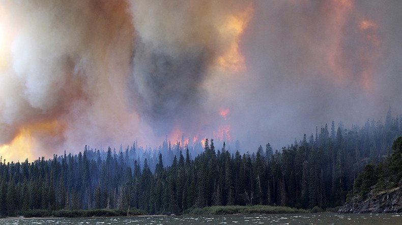
As Montana continues to be hit by some of the most intense wildfires in the state’s history, satellite images released by the US government show the true scale of blazes.
A number of ‘extreme’ fire warnings have been issued in the state since late June, with an estimated 578 square miles of land destroyed in areas around Missoula City, Garfield and Montana’s Petroleum County, reports ABC News.
It appears that the whole state of Montana is on fire🔥 pic.twitter.com/bisxcdjVtb
— Nikki (@Tinynikki) August 1, 2017
Montana on fire. #sunrisefirepic.twitter.com/I0N9LObVXs
— Jeff Towery (@JRTowery) August 2, 2017
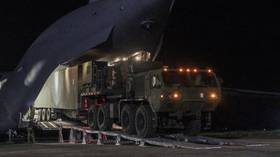
A super scooper plane loads up at Seeley Lake last night while fighting the Rice Ridge Fire visible in the background.. #mtfire#mtnewspic.twitter.com/cXkNxgWoo0
— Montana Public Radio (@mtpublicradio) August 2, 2017
The largest fire has spread across western Montana in an area known as the Lodgepole Complex, and is the worst in the state since 1910, according to the National Interagency Fire Center.
The Lodgepole Complex in Montana has burned over 270,000 acres. This is the largest fire in Montana since the 1910 fires.
— BLM NIFC (@BLMNIFC) July 29, 2017
Hazardous conditions experienced on the ground prompted Montana Governor Steve Bullock to declare an emergency on July 23, in an effort to acquire additional state resources to fight the fires.
Funds to tackle the problem appear to be dwindling, however, with Montana’s Department of Natural Resources and Conservation reporting that it has already spent the bulk of its $63 million firefighting budget.
Smoke from fires in #BC, #Montana, & #Idaho spreads far & wide in this #GOES16 loop. See more on GOES-16 & fire @ https://t.co/wXoDPHBi3Rpic.twitter.com/576IwAr7x6
— NOAA Satellites (@NOAASatellites) August 1, 2017
Images released by the US National Oceanic and Atmospheric Administration reveal fires burning in the west of Montana intensified between July 31 and August 1.
Captured by the agency’s GOES-16 weather satellite, the pictures from space also depict fires in nearby state of Idaho and Canada’s British Columbia.
PHOTO: Coast Mountain range this morning as #BCwildfire smoke from the Interior starts to drift towards the ocean. pic.twitter.com/AHRFjTRwR3
— BC Wildfire Service (@BCGovFireInfo) August 1, 2017
Approximately 10 square miles of land is currently under threat in Idaho, report InciWeb, a US interagency site concerned with wildfires.
Meanwhile, around 151 fires have been burning in British Columbia, Canada, since July.
On Tuesday, the government of British Columbia announced that fire suppression in Harrop Creek had been disrupted by the theft of a water pump and hosepipe equipment.